Mahul Village Chembur Mumbai – Location, History, Connectivity, Crisis & Complete Guide
There are addresses in Mumbai where market forces have turned old fishing villages into luxury apartment destinations. Mahul is not one of them. It sits on the eastern seafront of the Mumbai Suburban district in Chembur, surrounded by three oil refineries and sixteen chemical factories, and its name appears in the national press almost exclusively alongside words like “toxic,” “crisis,” and “displacement.” It is a place of genuine complexity — an original Koli fishing settlement whose population was displaced by industrial encroachment, later repurposed as a rehabilitation colony for slum dwellers displaced from other parts of Mumbai, and now home to approximately 30,000 people living in conditions that IIT Bombay’s own survey described as unfit for habitation. Understanding Mahul requires understanding both what it was and what it has been forced to become.
Mahul Village Chembur Mumbai – Quick Overview Table
| Detail | Information |
| Location | Chembur East, Eastern Seafront, Mumbai Suburban District, Maharashtra |
| Pin Code | 400074 |
| District | Mumbai Suburban |
| Ward | M/West Ward (Chembur-Mahul zone) |
| Assembly Constituency | Chembur / Anushakti Nagar |
| Lok Sabha Constituency | Mumbai South Central |
| Nearest Railway Stations | Chembur Station – Harbour Line (~8 km); Kurla – Central/Harbour (~12 km) |
| Monorail Access | Mumbai Monorail (Chembur to Wadala-Chembur section) accessible via road |
| Approximate Population | ~30,000 residents (2019 RTI data estimate); 5,500 families |
| Rehabilitation Complex | Eversmile Complex – 72 buildings, 16.15 hectares, MMRDA-built |
| Original Purpose | BRIMSTOWAD (Brihanmumbai Storm Water Disposal) displaced families |
| Industrial Surroundings | BPCL refinery; HPCL refinery; RCF fertiliser; 16 chemical factories |
| Connectivity Rating | 3.7/5 (99acres residents) |
| Safety Rating | 3.7/5 |
| IIT Bombay Assessment (2018) | Unsafe conditions; air pollution, sewage overflow, water contamination |
| Key Health Issues Documented | Breathing problems; skin conditions; eye irritation; hair loss; blood pressure |
| RTI Data (Deaths) | 88 deaths in two years prior to 2019 RTI filing, attributed to pollution |
| Adjacent Areas | Chembur; Trombay; Ambapada; Chereshwar |
History — From Fishing Village to Industrial Zone to Rehabilitation Colony
The story of Mahul spans three distinct chapters, each one more difficult than the last.
In its original form, Mahul was part of the Mahul-Trombay belt — a sparsely populated region on Mumbai’s eastern coast, home to Koli fishing communities and thick mangrove forests. The eastern seafront location made it a natural fishing base. Like the rest of Mumbai’s coastline, the Koli people were Mahul’s first inhabitants, living from the sea.
The industrial chapter began when refineries and chemical factories started arriving in the Chembur-Trombay belt. BPCL’s Chembur refinery, HPCL’s refinery, and the Rashtriya Chemicals and Fertilizers (RCF) complex are among the largest and heaviest industrial facilities in Mumbai. Their arrival made the air around Mahul progressively more unbreathable — and the Koli fishing families, who had lived on this coast for generations, eventually left. The pollution had become unbearable for the original inhabitants long before the rehabilitation colony was created.
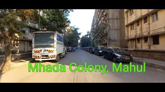
The third and most troubling chapter began with the Brihanmumbai Storm Water Disposal System (BRIMSTOWAD) project, which displaced hutment dwellers from various parts of Mumbai. As a response to court orders under PIL proceedings, the Maharashtra government began rehabilitating displaced families at Mahul. A Bombay High Court order from 2009 directed rehabilitation here. By 2017, approximately 5,500 families — nearly 30,000 people — had been moved into the Eversmile Complex: 72 identical buildings on 16.15 hectares, developed by MMRDA.
The buildings were built. But Mahul’s surrounding industrial reality was never addressed. The three refineries and sixteen chemical factories remained. Maharashtra Pollution Control Board data confirmed dangerous pollution levels. IIT Bombay’s 2018 survey — commissioned by the Bombay High Court — reported unsafe conditions across air quality, sewage overflow, sanitary fixtures, and water contamination. An RTI response documented 88 deaths over two years attributable to the pollution. Residents reported breathing problems, skin conditions, eye irritation, rapid hair loss, and elevated blood pressure. In 2018, Mumbai Police were also assigned residence quarters here — but no police personnel shifted in, citing high pollution levels and absence of schools.
The Pollution Reality
The 33% figure is important context: according to Mumbai’s Clean Air Action Plan 2019, approximately 33% of Mumbai’s air pollution originates from the industrial cluster at Mahul, Chembur, and Trombay. This is not a peripheral industrial zone — it is Mumbai’s single largest pollution source. The effluents from oil refineries and fertiliser plants have also polluted seawater in Thane Creek and affected marine life across the eastern coast.
The practical daily reality for Mahul residents is: no hospitals within the locality, no medical shops, limited school access (children travel to Chembur and Kurla on days they can afford the bus fare), no regular commercial retail, and air that carries a constant chemical smell. Every resident interviewed in published accounts was either coughing or wheezing during visits. The IIT Bombay survey documented overcrowding that exceeds the National Building Code’s density norms by three times.
Connectivity
By Rail: Chembur Railway Station on the Harbour Line is approximately 8 km from Mahul — accessible by road or bus. Kurla Junction, which connects to the Central Line, Harbour Line, and Trans-Harbour Line, is approximately 12 km away. Neither distance is walking-range; the bus system, which residents describe as irregular, is the primary link.
By Monorail: The Mumbai Monorail’s Chembur terminus is accessible via road, providing some connectivity toward Wadala and beyond. For Mahul residents, this requires reaching Chembur first.
By Bus: BEST buses serve Mahul but residents consistently report irregular frequency, and the cost of daily commuting has been documented as a barrier that causes children to miss school on days families cannot afford the fare.
Key Nearby Areas and Infrastructure
BPCL Chembur Refinery — The refinery immediately adjacent to Mahul, one of three industrial installations surrounding the locality.
RCF (Rashtriya Chemicals and Fertilizers) — The fertiliser complex in the Trombay-Mahul belt.
Chembur (~8 km) — The nearest commercial zone with hospitals (KEM, Tata Memorial, Wadia Hospital are accessible from Chembur), schools, markets, and rail connectivity.
Mangrove Belt — The eastern coast around Mahul retains some mangrove coverage, representing the ecological remnant of what was once a natural coastal environment before industrial development.
5 FAQs About Mahul Village Chembur Mumbai
Q1. What is Mahul village Chembur Mumbai known for?
Mahul is a Chembur East fishing village turned rehabilitation colony, known primarily for its severe industrial pollution — surrounded by three oil refineries and sixteen chemical factories. Approximately 30,000 people live in its 72-building Eversmile Complex in conditions that IIT Bombay’s 2018 survey and Maharashtra Pollution Control Board data have both declared unsafe. Pin code: 400074.
Q2. Why do people live in Mahul despite the pollution?
Most residents were resettled here involuntarily — displaced from other parts of Mumbai under BRIMSTOWAD, Bombay High Court rehabilitation orders, and slum clearance schemes. Many had no alternative housing option and were moved to Eversmile Complex as their rehabilitation entitlement. Leaving requires either finding alternative housing or returning to informal settlements elsewhere.
Q3. How far is Mahul from Chembur Railway Station?
Approximately 8 km from Chembur Station (Harbour Line) and approximately 12 km from Kurla Junction. Neither is walkable; residents depend on BEST buses which are reported as infrequent, making the cost of daily commuting a documented hardship.
Q4. What industrial facilities surround Mahul village?
BPCL Chembur Refinery, HPCL Refinery, and the RCF (Rashtriya Chemicals and Fertilizers) complex are the three refineries. Sixteen additional chemical factories are in the immediate belt. According to Mumbai’s Clean Air Action Plan 2019, this cluster generates approximately 33% of Mumbai’s total air pollution.
Q5. What did the IIT Bombay survey find about Mahul?
Commissioned by the Bombay High Court in 2018, IIT Bombay’s survey of Mahul found unsafe conditions across air quality, sewage overflow, sanitary fixtures, and water contamination. It documented overcrowding that exceeds National Building Code density norms three times over, and conditions that severely compromise human dignity, safety, security, and decent living.