Katai Village Mumbai – Location, History, Connectivity, Nearby Places & Complete Guide
The Kalyan-Shilphata Road corridor — the arterial stretching from Dombivli East toward the Shilphata junction — carries one of the Mumbai Metropolitan Region’s most consequential infrastructure stories of the current decade. Running along this corridor, functioning as both a village settlement and the named endpoint of a transformative freeway project, is Katai. A census town in Thane district with a recorded population of 11,250 in 2001, Katai sits at the junction where the Airoli-Katai Naka Freeway — a 12.3 km elevated road project being built by MMRDA — terminates at Katai Naka on the Kalyan-Shilphata Road. Everything that happens around this freeway happens around Katai. The Palava City township developed by Lodha Group, the Diva-Panvel railway line, the Kalyan-Shilphata Road, and the approach of Mumbai Metro Line 12 (Kalyan-Taloja) — all of it converges in the zone whose naka (junction) carries this village’s name.
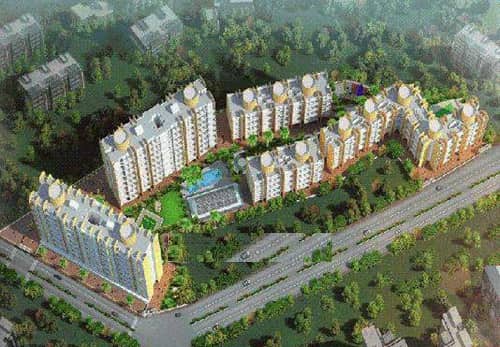
Katai Village Mumbai – Quick Overview Table
| Detail | Information |
| Location | Dombivli East / Kalyan-Shilphata Road corridor, Thane District, Maharashtra |
| Pin Code | 421204 |
| District | Thane |
| Census Status | Census town (2001 population: 11,250) |
| Primary Road | Kalyan-Shilphata Road; Katai Naka–Badlapur Road |
| Key Infrastructure Landmark | Katai Naka — western terminus of Airoli-Katai Naka Freeway (MMRDA) |
| Airoli-Katai Freeway | 12.3 km; Phases 1 & 2 targeting operational status; Phase 3 under construction (₹1,981 crore) |
| Nearest Railway Station | Nilaje Railway Station (Diva-Panvel line) |
| Distance from Diva Railway Station | Approximately 5–7 km |
| Nearest Metro (current) | Sector 11 Kharghar / Science Park Metro Station (~via Navi Mumbai, approx. 20 km) |
| Property Rate | ₹4,000–₹7,000 per sq ft |
| Monthly Rent | ₹6,000–₹70,000 (1BHK to 3BHK) |
| Key Bus Stops | Palava City Bus Stop; Casa Bella Magnifica Bus Stop; Katai Gaon; Katai Naka |
| Key Nearby Projects | Palava City (Lodha Group); Lodha Upper Thane; Marathon Nextown |
| Key Landmarks | Katai Toll Naka; Nilaje Gaon |
| Upcoming Infrastructure | Phase 3 Airoli-Katai Freeway (NH-48 to Katai Naka, 6.3 km, parallel to Diva-Panvel railway line) |
| Travel Time to Airoli (post-freeway) | Approximately 20 minutes; Dombivli to Mumbai in 15–20 minutes |
History and Transformation
Katai’s origin is agricultural — a traditional Maharashtrian village on the Dombivli-Kalyan eastern fringe of Thane district, where farming and livestock defined the community’s livelihood before urbanisation reached this part of the MMR. The surrounding landscape of the Kalyan-Shilphata corridor was relatively undeveloped through the 1990s and early 2000s, with the area considered “too remote” for serious real estate interest. That changed with two developments arriving almost simultaneously: the Lodha Group’s Palava City township — a massive planned township that has become one of India’s largest integrated residential developments — and MMRDA’s Airoli-Katai Naka Freeway project, which placed Katai’s junction name on infrastructure maps across the Metropolitan Region.
The Airoli-Katai Naka Freeway is a 12.3 km six-lane elevated road being developed under the Extended Mumbai Urban Infrastructure Project (MUIP). Its alignment begins at the Airoli end of the Mulund-Airoli Bridge, crosses the Thane-Belapur Road and NH-4, and terminates at Katai Naka on the Kalyan-Shilphata Road — running parallel to the Diva-Panvel railway line for much of Phase 3. The project includes a 1.7 km twin tunnel cutting through Parsik Hill — eliminating the Mahape and Mumbra bypass that currently adds an hour to peak-hour journeys from Dombivli to Mumbai. When Phases 1 and 2 become operational and Phase 3 is complete, Dombivli and Palava will be 20 minutes from Airoli and 30 minutes from Mulund, connecting residents to the Eastern Express Highway and the Western Suburbs in around an hour.
For Katai village, this transformation means the gradual conversion from agricultural settlement to a residential suburb in the catchment zone of Palava and the freeway corridor. Property rates of ₹4,000–₹7,000 per sq ft and rentals of ₹6,000–₹70,000 per month reflect a market that is affordable relative to core Dombivli while being directly tied to freeway-driven appreciation.
Connectivity
By Rail: Nilaje Railway Station on the Diva-Panvel suburban line is the nearest rail connection, providing access toward Diva Junction (connecting to the Central Line) and southward toward Panvel. Diva Junction connects directly to Mumbai CST via the Central Line.
By Road: The Kalyan-Shilphata Road is the primary arterial, with the Katai Naka junction serving as the freeway terminus. NH-48 (the old Pune Highway corridor) is accessible from the Phase 3 freeway alignment. The Badlapur-Katai Road extends southward, and a flyover has been approved for Nevali Chowk on this stretch.
Upcoming Metro: Mumbai Metro Line 12 (Kalyan-Taloja) will further improve east-west connectivity in this corridor when construction progresses.
Key Landmarks and Nearby Places
Palava City (Lodha Group) — India’s largest integrated township, immediately adjacent to the Katai belt, providing retail, schools, hospitals, and entertainment within minutes.
Katai Toll Naka — The road junction that has become a regional navigation landmark, the endpoint of the MMRDA freeway.
Nilaje Railway Station — The nearest suburban rail access on the Diva-Panvel line.
5 FAQs About Katai Village Mumbai
Q1. What is Katai village Mumbai known for?
Katai is a Thane district census town (pin 421204) on the Kalyan-Shilphata Road in Dombivli East, known as the named terminus of the MMRDA Airoli-Katai Naka Freeway (12.3 km), adjacency to Palava City (Lodha), and the Nilaje Railway Station on the Diva-Panvel line. Property rates: ₹4,000–₹7,000/sq ft.
Q2. What is the Airoli-Katai Naka Freeway?
An MMRDA 12.3 km six-lane elevated freeway connecting Airoli to Katai Naka on Kalyan-Shilphata Road, including a 1.7 km twin tunnel through Parsik Hill. Phases 1 and 2 near operational; Phase 3 (6.3 km, ₹1,981 crore) under construction. When complete, Dombivli to Airoli will take approximately 20 minutes.
Q3. Which is the nearest railway station to Katai village?
Nilaje Railway Station on the Diva-Panvel suburban line. Diva Junction (Central Line to Mumbai CST) is approximately 5–7 km away.
Q4. What is the current property rate in Katai village?
₹4,000–₹7,000 per sq ft for purchase; ₹6,000–₹70,000 per month rent for 1BHK to 3BHK. The corridor is seeing appreciation driven by Airoli-Katai Freeway progress and Palava City development.
Q5. How will the Airoli-Katai Freeway change daily life in Katai?
Travel from Dombivli to Airoli will reduce to about 20 minutes, Mulund becomes 30 minutes away, and the Eastern Express Highway becomes accessible in 15–20 minutes from Dombivli. This fundamentally changes the commute calculus for residents of Katai and Palava City, making Mumbai’s employment zones genuinely accessible.