Goyla Village Delhi – Location, History, Connectivity, Nearby Places
Delhi’s southwestern agricultural belt — the zone stretching from Dwarka’s planned sectors westward toward Najafgarh’s lake district — has a different character from the rest of the capital. It is greener, flatter, and more genuinely rural in the spaces between its settlements. Goyla village sits in this belt: a West Delhi village in the Nangli Sakravati ward area, carrying pin code 110071, adjacent to Qutub Vihar, Chhawla, and the Dwarka Sector 17–19 corridor. The name “Goyla” — sometimes written Goyala — carries an agricultural root: a “goyla” or “goyala” in north Indian dialects refers to a cowshed or cattle enclosure, indicating a settlement historically built around cattle rearing and dairy. This etymology fits perfectly with the village’s documented character as a dairy and farming settlement within Delhi’s western agricultural fringe.
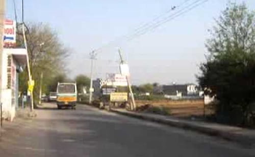
Goyla Village Delhi – Quick Overview
| Detail | Information |
| Location | Nangli Sakravati Ward area, West Delhi District, Delhi |
| Pin Code | 110071 |
| District | West Delhi |
| Ward | Nangli Sakravati Ward |
| Assembly Constituency | Matiala |
| Assembly MLA | Gulab Singh |
| Lok Sabha Constituency | West Delhi |
| Parliament MP | Parvesh Sahib Singh Verma |
| Post Office | Chhawla |
| Primary Roads | Dwarka Goyla Dairy Road; Najafgarh-Kapashera Road |
| Nearest Railway Stations | Shahabad Mohammadpur Railway Station; Bijwasan Railway Station |
| Nearest Metro Stations | Dwarka Sector 17 – Blue Line; Dwarka Sector 19 – Blue Line |
| Key DTC Bus Routes | 833 (Karampura Terminal–Goela Dairy); 873 (Tilak Nagar–Tajpur Khurd); RL 77A (New Delhi Railway Station–Dwarka Sector 18B) |
| Key Sub-localities | Goyla Khurd (main village); Goyla Vihar; Goyla Dairy; Shyam Vihar |
| Key Neighbouring Areas | Qutub Vihar; Chhawla; Kakrola; Deenpur; Dwarka Sector 17–19; Najafgarh |
| Key Government Facility | DGD Sec 17 Dwarka (Delhi Govt. Dispensary); DGD Dindarpur (nearby) |
| Key Landmarks | Goyla Football Stadium; Goyla Dairy (historic dairy area) |
| Nearby Hospitals | DGD Sec 17 Dwarka; hospitals in Dwarka sectors 10–19 |
| Key Schools | St. Thomas School Goyla Vihar; Shanti Gyan Niketan Sr. Sec. Public School; Mata Bhati Devi Public School |
History and Etymology
Goyla’s name derives from its cattle heritage — a “goyala” is a traditional north Indian term for a cowshed or cattle enclosure. The village developed as a dairy and agricultural settlement in the southwestern Delhi plain, where the alluvial land adjoining the Najafgarh lake basin historically supported extensive cattle rearing and milk production. Goyla Dairy — the sub-locality whose name specifically preserves this dairy tradition — reflects the scale at which milk and dairy products were produced here for Delhi’s markets.
The village falls within the broader southwestern Delhi agricultural belt that includes Chhawla, Kakrola, Deenpur, Dhul Siras, and Najafgarh as neighbours — a cluster of older settlements that the DDA’s Dwarka sub-city expansion progressively approached without fully absorbing. The Matiala assembly constituency, which covers Goyla along with Pochanpur, Bamnoli, Paprawat, and other southwestern villages, represents this entire agricultural fringe zone.
The village now contains multiple sub-localities: Goyla Khurd (the main village gaothan), Goyla Vihar (a developed residential extension), and Goyla Dairy (the dairy-tradition named area). Each carries the same pin code 110071 under the Chhawla post office jurisdiction.
Connectivity
By Metro: Dwarka Sector 17 and Dwarka Sector 19 on the Blue Line are the nearest metro options — accessible via Dwarka Goyla Dairy Road and the connecting sector roads. The Blue Line connects toward central Delhi and the NCR’s eastern corridor.
By Road: Dwarka Goyla Dairy Road and the Najafgarh-Kapashera Road are the primary arterials. DTC bus routes — 833 (Karampura Terminal to Goela Dairy), 873 (Tilak Nagar to Tajpur Khurd), and RL 77A (New Delhi Railway Station Gate No. 1 to Dwarka Sector 18B) — provide regular public bus connectivity.
By Rail: Shahabad Mohammadpur Railway Station and Bijwasan Railway Station are the nearest suburban rail connections on the Delhi Cantonment corridor.
Key Landmarks and Nearby Places
Goyla Football Stadium — A local sports facility within the village belt, providing recreational infrastructure for the community.
Goyla Dairy — The sub-locality that preserves the village’s dairy heritage in its very name, still an operational dairy area.
Qutub Vihar — The nearest major planned colony providing commercial, educational, and healthcare infrastructure accessible from Goyla.
Najafgarh Lake (Wetland Reserve, ~5 km) — Delhi’s designated Ramsar Wetland site and largest urban bird sanctuary, accessible from the broader Goyla-Najafgarh belt.
Dwarka Sectors 17–19 — The planned DDA sectors providing hospital, school, and commercial services within practical commuting distance.
FAQs About Goyla Village Delhi
Q1. What is Goyla village Delhi known for?
A: Goyla (also spelled Goyala) is a West Delhi agricultural village in the Matiala constituency belt, known for its dairy heritage (“goyala” meaning cowshed in north Indian dialects). Sub-localities include Goyla Khurd, Goyla Vihar, and Goyla Dairy. Pin code: 110071; post office: Chhawla; ward: Nangli Sakravati.
Q2. Which is the nearest metro station to Goyla village Delhi?
A: Dwarka Sector 17 and Dwarka Sector 19 Metro Stations on the Blue Line are the nearest, accessible via Dwarka Goyla Dairy Road. The Blue Line connects toward central Delhi, Connaught Place, and the NCR eastern corridor.
Q3. What is the pin code of Goyla village Delhi?
A: 110071. Post office: Chhawla. Assembly constituency: Matiala (MLA: Gulab Singh). Lok Sabha: West Delhi (MP: Parvesh Sahib Singh Verma). All Goyla sub-localities (Goyla Khurd, Goyla Vihar, Goyla Dairy) carry this pin code.
Q4. What DTC bus routes serve Goyla village?
A: Bus 833 (Karampura Terminal to Goela Dairy), Bus 873 (Tilak Nagar to Tajpur Khurd), and RL 77A (New Delhi Railway Station Gate No. 1 to Dwarka Sector 18B) are the primary DTC routes serving the Goyla belt.
Q5. What are the key landmarks near Goyla village Delhi?
A: Goyla Football Stadium (local sports facility), Goyla Dairy sub-locality (historic dairy tradition), Qutub Vihar (nearest commercial colony), Najafgarh Lake/Ramsar Wetland (~5 km), and Dwarka Sectors 17–19 providing hospital and commercial infrastructure.