Palam Village Delhi – History, Metro Connectivity, Nearby Places & Complete Guide
Every city eventually grows around the thing it was named after, and forgets why. Delhi’s Indira Gandhi International Airport was called Palam Airport for decades — named after the ancient village that existed here long before the runway did. The renaming happened in 1986. The village, pressed between Palam Colony and the airport perimeter, is still here, still called Palam, and still carrying the weight of a history that long predates both civil aviation and South West Delhi district.
Palam village is not a tourist destination in any conventional sense. It is a dense, lived-in urban village in South West Delhi — historically significant, practically situated near IGI Airport, and now connected to the rest of the city via an underground Magenta Line metro station that opened in 2018. For anyone trying to understand this corner of Delhi, starting with the village is the right place.
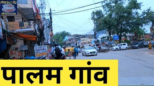
Palam Village Delhi – Quick Overview
| Detail | Information |
| Location | South West Delhi District, Delhi |
| Pin Code | 110045 |
| Administrative Area | South West Delhi Tehsil |
| Assembly Constituency | Palam |
| Assembly MLA | Bhavna Gaur |
| Lok Sabha Constituency | West Delhi |
| Nearest Metro Station | Palam Metro Station – Magenta Line (Delhi Metro); underground; opened 29 May 2018 |
| Nearest Railway Station | Palam Railway Station (Ring Railway) |
| IGI Airport Distance | Approx. 4–7 km |
| Distance from Central Delhi | Approx. 20 km southwest of New Delhi city centre |
| Key Historical Feature | One of Delhi’s oldest surviving villages; Qutb Shahi mosque; Shri Shanti Nath Digambar Jain Mandir (500+ years old) |
| Best For | Affordable residential housing near IGI Airport, heritage interest, airport-area transit |
Where Is Palam Village Delhi?
Palam village sits in South West Delhi, approximately 20 km southwest of Connaught Place. It is bounded by Palam Colony, Nasirpur, Bagrola, Dabri, and Dwarka Sector 6 — placing it squarely in the dense residential-commercial belt that links Dwarka with the airport approach corridor.
The village’s geography has always been shaped by proximity to power. During the Delhi Sultanate period, it lay on important trade and military routes. In the 20th century, it was absorbed into the aeronautical identity of the capital — the original airstrip established by the British in the 1920s nearby gave the area its lasting modern association. The airport grew, the village remained. Today Palam village is a surviving pocket of pre-Partition Delhi within a fully urbanised administrative district, which is exactly what makes it worth knowing about.
History of Palam Village Delhi
Palam’s recorded history is among the longer ones in Delhi’s revenue village ledger. The name is believed to derive from Palamba, and some historical accounts link the original settlement to the Tomar dynasty — the same rulers associated with founding the ancient city of Dhilli. The village is considered part of the wider archaeological and cultural geography that produced Delhi’s medieval core.
The Qutb Shahi mosque within the village is a significant heritage structure. A Jain temple, Shri Shanti Nath Digambar Jain Mandir, has stood here for over 500 years — testimony to the Jain community’s deep roots in Palam alongside the dominant Jat population. The Dada Dev Mandir, accessible from Palam Metro Station Gate 2, is another locally important religious site.
The airport connection is a post-Independence addition to this long timeline. When the British-era Palam airstrip was developed into a civil and military airport after 1947, the surrounding area took the village’s name formally. It remained Palam Airport until 1986, when it was renamed Indira Gandhi International Airport following the assassination of Prime Minister Indira Gandhi. The airport kept expanding; the village stayed, absorbed into the urban fabric but not erased by it.
How to Reach Palam Village Delhi
By Metro (Magenta Line – Delhi Metro): Palam Metro Station is the most convenient transit point. It is an underground station on the Magenta Line (Line 8), opened to the public on 29 May 2018. The Magenta Line runs from Botanical Garden in Noida to Janakpuri West (with further Phase 4 extensions operational toward Krishna Park Extension). Gate 2 and Gate 3 of Palam Metro Station both provide access directly toward Palam Village, Sadh Nagar, Palam Colony, Dada Dev Mandir, and Palam Railway Station. The Magenta Line connects to the Blue Line at Dwarka Sector 21, the Yellow Line at Hauz Khas, and the Pink Line at Janakpuri West, giving Palam village comprehensive metro reach across Delhi and into Noida.
By Rail: Palam Railway Station on Delhi’s Ring Railway network is within easy distance of the village. The Ring Railway provides connections to Delhi Cantonment, Hazrat Nizamuddin, New Delhi, and Sarai Rohilla. Shahabad Mohammadpur Railway Station is another nearby option.
By Road: Dabri–Gurgaon Road, Dwarka Road, and Kailashpuri Road are the primary arterials serving the area. NH-48 is approximately 7 km out, connecting toward Gurgaon’s commercial corridors. The Delhi–Gurgaon Expressway is accessible via Dwarka. Multiple DTC bus routes connect Palam to various parts of Delhi including bus stops at Sector 15A/16A Ajronda Mod, City Centre Bus Station, and along the Palam–Dwarka axis.
Key Landmarks and Nearby Places Around Palam Village Delhi
Indira Gandhi International Airport (4–7 km)
IGI Airport — formerly Palam Airport — is the country’s busiest airport and the single most defining infrastructure feature near the village. Terminal 3, India’s flagship international terminal, is approximately 12 km from the Palam metro area by road, though the broader airport perimeter begins much closer. The proximity drives a persistent demand for budget hotels, paying-guest accommodations, and serviced apartments throughout the Palam–Mahipalpur–Vasant Kunj belt.
Palam Metro Station and Dada Dev Mandir
Gate 2 of Palam Metro Station leads directly toward the Dada Dev Mandir, one of South West Delhi’s more visited religious sites. The mandir draws steady footfall from across the Palam–Dwarka corridor, particularly during festival periods.
Shri Shanti Nath Digambar Jain Mandir
One of the oldest surviving structures in Palam village, this Jain temple is believed to be over 500 years old. It stands as tangible evidence of the village’s pre-medieval continuity and is among the more historically significant religious sites in this part of South West Delhi.
Janakpuri District Centre (approx. 6 km)
The primary commercial hub for western Delhi, Janakpuri District Centre hosts banks, retail, restaurants, and professional services that form part of Palam’s daily commercial orbit. Pacific Mall, Vegas Mall, and Unity One are within 7 km, handling the area’s retail and entertainment needs.
Dwarka Sub-City (approx. 2–4 km)
India’s largest planned residential township, developed by DDA, Dwarka is effectively Palam’s premium residential neighbour. Dwarka Sector 6 is approximately 2 km from Palam village. Its malls, hospitals, schools, and parks serve the Palam catchment as readily as they serve Dwarka proper.
DLF Cyber City, Gurgaon (approx. 18 km)
Via Dwarka Expressway or NH-48, Cyber City’s IT corridor is approximately 18 km from Palam. For professionals working in Gurgaon’s tech and financial services districts, Palam and its surroundings offer more affordable housing than the Gurgaon side of the border, with reasonable road and metro access.
Real Estate and Living in Palam Village Delhi
Palam offers a housing market that consistently prices below Dwarka’s planned sectors despite broadly similar physical access to the same infrastructure. The stock includes builder floors, DDA flats, CGHS cooperative housing societies, and older independent homes within the village proper.
Property rates in Palam and Palam Colony are positioned as an affordable alternative to Dwarka — relevant for buyers priced out of Dwarka Sectors 6–23 but unwilling to compromise on airport proximity or metro access. Rental demand is partly sustained by airport-area workers, airline staff, and transient professionals who need frequent IGI access without paying Vasant Kunj or Mahipalpur rates.
Congestion is the most consistently cited trade-off by residents — both internal lane density within the village and traffic on surrounding arterials during peak hours. Parking within the village is limited. Basic social infrastructure — schools, clinics, local markets — is present and functional. For larger retail, healthcare, and entertainment, residents rely on Dwarka and Janakpuri.
FAQs About Palam Village Delhi
Q1.What is Palam village Delhi famous for?
A: Palam village is historically significant as one of Delhi’s oldest surviving settlements, with origins traced to the Tomar period. It is the village that gave IGI Airport its original name — the airport was called Palam Airport until 1986. The village contains a 500+ year old Jain temple (Shri Shanti Nath Digambar Jain Mandir) and the historically notable Qutb Shahi mosque. Today it is primarily known as a dense residential locality close to IGI Airport.
Q2. Which is the nearest metro station to Palam village Delhi?
A: Palam Metro Station on the Magenta Line (Line 8) of the Delhi Metro is the nearest and most directly connected station. It is underground, opened 29 May 2018, and Gate 2 and Gate 3 provide direct access toward Palam Village, Palam Colony, and Dada Dev Mandir. The Magenta Line connects to Noida (Botanical Garden) in the east and Janakpuri West in the west, with onward interchange to the Blue, Yellow, and Pink Lines.
Q3. How far is Palam village from IGI Airport?
A: Approximately 4–7 km depending on the terminal and route. The airport perimeter begins very close to the village’s western edge. IGI Terminal 3 is roughly 12 km by road from the Palam metro area. The proximity makes Palam and its surrounding colony a practical base for frequent flyers, airline crew, and airport industry workers.
Q4. Is Palam village good for residential living in Delhi?
A: It is a practical, affordable option for those working near IGI Airport, in Gurgaon, or needing Magenta Line metro access. The combination of an underground metro station, Ring Railway access, airport proximity, and lower property rates than Dwarka makes it a rational choice for a specific residential profile. Trade-offs include peak-hour congestion, limited internal road width within the village, and the general density of an old urban village that has absorbed decades of growth without planned infrastructure upgrades.
Q5. Why was IGI Airport previously called Palam Airport?
A: The airstrip in this area was developed by the British in the 1920s–30s and named after the adjacent Palam village — then a significant settlement near Delhi’s western edge. After Independence, it was expanded into India’s main international airport and continued to be officially called Palam Airport. Following the assassination of Prime Minister Indira Gandhi in 1984, the airport was renamed Indira Gandhi International Airport in 1986. The village, however, retained its original name.