Jharsa Village Gurugram – Location, History, Connectivity, Nearby Places & Complete Guide
Gurugram’s most recognisable narrative is its speed — farmland to glass towers in thirty years, fields to Formula 1 traffic on the Delhi–Gurugram Expressway within a generation. Most of the old villages that predated this transformation have been absorbed, renamed, or demolished. Jharsa is one of the few that survived it with its identity intact. Located in Sector 39, Gurugram, with a population of approximately 32,709 and a history reaching back to the Mughal era when it was a paragana in Delhi Subah, Jharsa sits at the intersection of Gurugram’s corporate geography and its agricultural-village past — 10 kilometres from the city centre, surrounded on all sides by sectors 15, 31, 32, 38, 39, 40, 45, 46, and 47.
Jharsa Vcillage Gurugram – Quick Overview Table
| Detail | Information |
| Location | Sector 39, Gurugram, Haryana |
| Pin Code | 122022 (Jharsa Village, Sector 39); 122003 (Jharsa main) |
| District | Gurugram |
| State | Haryana |
| Population | Approximately 32,709 |
| Distance from Gurugram City Centre | 10 km |
| Historical Period | Mughal era – paragana in Delhi Subah |
| Assembly Constituency | Badshahpur |
| Primary Road | Arya Samaj Marg; Jharsa Road; NH-48 (Delhi–Mumbai Expressway) accessible |
| Nearest Metro Station | Millennium City Centre – Yellow Line; approx. 3.2 km |
| Nearest Railway Station | Gurugram Railway Station – approx. 6.7 km |
| Surrounding Sectors | Sectors 31, 32, 38, 39, 40, 45, 46, 47 |
| Key Neighbouring Areas | Mohyal Colony; Patel Nagar; Kirti Nagar; Indra Colony; Rajiv Colony |
| Notable Religious Site | Jharsa Jain Temple |
History and Background
Jharsa is one of Gurugram’s oldest surviving settlements with documented Mughal-era administrative history. During the Mughal and British colonial period, Jharsa was a paragana — an administrative subdivision — in Delhi Subah (the Mughal province that covered the Delhi region), at a time when Gurgaon was itself a small village. The village thus predates Gurugram as an urban entity, a historical relationship that the modern infrastructure explosion has largely obscured but not erased.
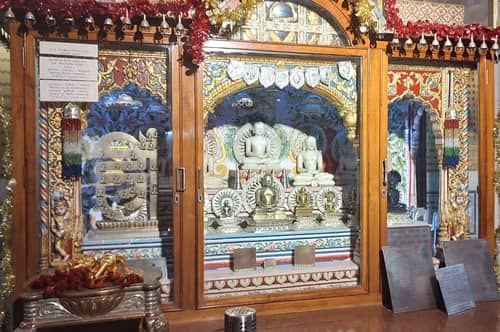
The Jharsa Jain Temple is the village’s most notable heritage landmark — a religious site that reflects the Jain community’s historical presence in this part of Haryana. Traditional agricultural families and the Jat community have been the dominant social groups in Jharsa across its historical period, with land-owning families holding village gram sabha land that has become increasingly valuable as Gurugram’s planned sector expansion surrounded the village on all sides.
Connectivity
By Metro: Millennium City Centre Metro Station on the Yellow Line (Huda City Centre, Phase 1) is approximately 3.2 km from Jharsa Village — accessible via Arya Samaj Marg and the sector road network. The Yellow Line connects Samaypur Badli in North Delhi through Central Delhi and Gurugram, providing direct access to IFFCO Chowk, MG Road, Huda City Centre, and onward to South Gurugram employment zones.
By Road: Arya Samaj Marg is the primary arterial road serving Jharsa, connecting to the broader sector road network of Gurugram’s planned zones. NH-48 (Delhi–Mumbai Expressway) is accessible from the village, providing the primary Delhi–Gurugram corridor. Dwarka Expressway, FNG Expressway, Golf Course Road, and KMP Expressway are all accessible from the Sector 39 belt, giving Jharsa’s residents connectivity options to virtually all of Gurugram’s employment zones.
By Rail: Gurugram Railway Station is approximately 6.7 km from the village — connected to the Delhi–Jaipur and Delhi–Mumbai mainlines.
Key Landmarks and Nearby Places
Unitech Cyber Park (~2 km) — A major IT park in Sector 39, one of several employment hubs within the immediate Jharsa neighbourhood.
Jharsa Jain Temple — The village’s heritage landmark, a significant religious site for the Jain community in the region.
Iffco Chowk and MG Road commercial belt (~4–5 km) — Gurugram’s primary retail and commercial corridor, accessible via Yellow Line metro from Millennium City Centre.
Golf Course Road employment corridor (~6–8 km) — Gurugram’s premium IT and financial services corridor, accessible via the sector road network.
Sector 31–32 Markets — The nearest established commercial zones for daily retail needs, within walking distance of the village.
Real Estate and Living
Jharsa’s property market is split between the village’s Lal Dora plots and builder floor developments in the adjacent Sector 39 planned zone. The Lal Dora area offers traditional village plots with multiple-floor construction potential at prices below the surrounding planned sectors. The broader Sector 39 neighbourhood carries property rates aligned with Gurugram’s mid-tier residential market. The demographic profile of young professionals, business executives, and families reflects the corporate Gurugram workforce that finds Jharsa’s Yellow Line proximity and sector road connectivity attractive at village-housing price points.
5 FAQs About Jharsa Village Gurugram
Q1. What is Jharsa village Gurugram known for?
Jharsa is a Mughal-era village in Sector 39, Gurugram, with a population of approximately 32,709 and historical status as a paragana in Delhi Subah. It is known for its strategic location surrounded by Gurugram’s planned sectors, Millennium City Centre Yellow Line metro access (3.2 km), and the Jharsa Jain Temple as a heritage landmark.
Q2. What is the pin code of Jharsa village Gurugram?
122022 for Jharsa Village, Sector 39 area. The older Jharsa settlement carries 122003. The area falls under Badshahpur assembly constituency, Gurugram district, Haryana.
Q3. Which is the nearest metro station to Jharsa village Gurugram?
Millennium City Centre Metro Station on the Yellow Line, approximately 3.2 km from the village. The Yellow Line provides direct connectivity to central Delhi, Connaught Place, and all major DMRC interchanges.
Q4. What roads connect Jharsa village to the rest of Gurugram?
Arya Samaj Marg is the primary village arterial. NH-48 (Delhi–Mumbai Expressway) is accessible nearby. The full array of Gurugram arterials — Dwarka Expressway, Golf Course Road, FNG Expressway — are accessible via the sector road network that surrounds the village.
Q5. Is Jharsa village a good place to live in Gurugram?
For professionals working in Sector 39’s IT parks, Golf Course Road’s financial district, or MG Road’s commercial zone — all accessible via Yellow Line metro and sector roads — Jharsa offers village-priced housing adjacent to planned sector infrastructure. Yellow Line metro at 3.2 km and NH-48 access are the primary connectivity advantages.