Hamidpur Village Delhi – Location, History, Connectivity, Nearby Places
Delhi’s northern fringe — the stretch from the Singhu border northward toward the Haryana boundary — is a geography of farmland and older villages that the city has not yet absorbed in the manner it consumed its western and eastern peripheries. Hamidpur sits in this belt: a village in the Narela tehsil of North Delhi district, 9 km from both Alipur and Narela, 343 hectares of predominantly agricultural land with a population of approximately 17,000+ across all its sub-localities. Its northern position keeps it away from Delhi’s metro network’s current reach, but the Singhu, Bakhtawarpur, and GT Karnal Road axis gives it the basic road-and-bus connectivity that sustains daily life at the capital’s edge.
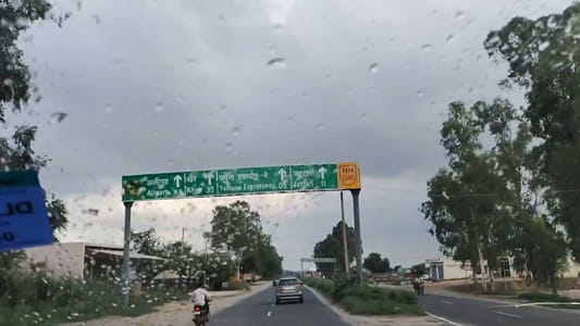
Hamidpur Village Delhi – Quick Overview
| Detail | Information |
| Location | Narela Tehsil, North Delhi District, Delhi |
| Pin Code | 110036 (Hamidpur sub-locality); 131023 (outer Hamidpur Village zones) |
| District | North Delhi |
| Tehsil | Narela |
| Total Area | 343.3 hectares (848 acres) |
| Population (2011 Census) | 3,469 (original village); 17,304 (broader Hamidpur Village locality) |
| Households | 644 (2011) |
| Distance from Alipur | 9 km |
| Distance from Narela | 9 km |
| Nearest Town | Narela (~9 km); Alipur (~9 km) |
| Average Property Rate | ₹5,650 per sq ft |
| Connectivity Rating | 3.6/5 (99acres residents) |
| Safety Rating | 3.5/5 |
| Key Nearby Localities | Singhu; Singhola; Bakhtawarpur; Bakoli; Palla; Alipur |
| Nearest Hospitals | Maujiram Lions Eye Hospital; Chouhan Hospital; Nirmal Hospital |
Location and Character
Hamidpur is a village in Narela tehsil of North Delhi district, situated in the northern agricultural belt that borders Haryana. It is surrounded by other northern Delhi villages — Singhu, Singhola, Bakhtawarpur, Bakoli, Palla — that share its rural-fringe character. Narela is the nearest town at approximately 9 km, providing the commercial and administrative infrastructure that Hamidpur residents access for major services.
The broader Hamidpur Village locality has a population of approximately 17,304 (GeoIQ data), spread across 6.44 square kilometres — a relatively dispersed density that reflects the agricultural character of the settlement rather than the dense urban village packing typical of Delhi’s more urbanised zones. The village retains a genuinely agricultural identity: residents consistently note the granary, open surroundings, and agricultural fields as positive environmental features.
Hamidpur’s name follows the standard Mughal-era settlement naming convention — “Hamid” being a Muslim personal name and “pur” meaning settlement — consistent with the widespread settlement-naming pattern of medieval north India. It is one of dozens of Delhi villages carrying this naming pattern, but its specific position in the Narela belt, its size, and its proximity to the Singhu-Bakhtawarpur corridor give it a distinct geographic identity.
Connectivity
By Road: GT Karnal Road is the primary arterial serving North Delhi’s northern belt, passing through Alipur toward the Haryana border. Hamidpur’s connection to this arterial via local village roads provides the primary commute route toward Delhi’s urban core. DTC bus routes run through the broader Narela-Alipur belt, connecting toward Jahangirpuri, Samaypur Badli, and the Yellow Line metro from those stations.
By Metro: Samaypur Badli Metro Station on the Yellow Line (Delhi Metro Line 2) is the nearest metro station at approximately 10–15 km — the primary metro option for residents who commute southward into central Delhi or Gurugram.
Key Landmarks and Nearby Places
Singhu Border — The Delhi-Haryana administrative boundary at Singhu, approximately 3–5 km from Hamidpur, is the primary road connection point to Haryana and onward to Kundli and Sonipat. The Singhu border gained national attention as the site of extended farmers’ protests in 2020–21.
Bakhtawarpur — A nearby village and emerging real estate market in the North Delhi belt, with the Eldeco Camelot project (₹7.42–8.28 Cr) listed as the top residential project in the Hamidpur Village zone.
Narela (9 km) — The nearest town, providing commercial markets, government offices, hospitals, and railway connectivity (Narela Railway Station).
Alipur (9 km) — The Alipur sub-district headquarters, providing administrative and commercial infrastructure.
FAQs About Hamidpur Village Delhi
Q1. What is Hamidpur village Delhi known for?
A: Hamidpur is a North Delhi agricultural village in the Narela tehsil, 9 km from both Alipur and Narela, known for its granary surroundings, open agricultural character, and proximity to the Singhu border corridor. Average property rate of ₹5,650/sq ft reflects a pre-growth northern fringe market.
Q2. Which is the nearest metro station to Hamidpur village Delhi?
A: Samaypur Badli Metro Station on the Yellow Line is the nearest substantial metro option, approximately 10–15 km south via GT Karnal Road. The Green Line at Rohini Sector 18 is another option for the broader belt.
Q3. What is the pin code of Hamidpur village Delhi?
A: 110036 for the Hamidpur sub-locality. The broader Hamidpur Village zone carries 131023 in some references. The Narela tehsil administration covers the village under North Delhi district.
Q4. How far is Hamidpur from Narela?
A: Approximately 9 km via local village roads connecting to GT Karnal Road. Narela is the nearest town and the primary reference point for major commercial, administrative, and railway connectivity.
Q5. Is Hamidpur a good investment location in Delhi?
A: At ₹5,650/sq ft average, Hamidpur is a northern fringe market with the Eldeco Camelot premium project (₹7.42–8.28 Cr) as the anchor quality development. Investment value depends on northern Delhi infrastructure expansion — the Narela industrial belt and improved GT Karnal Road connectivity are the primary development catalysts.