Jharera Village Delhi – Location, History, Connectivity, Nearby Places & Complete Guide
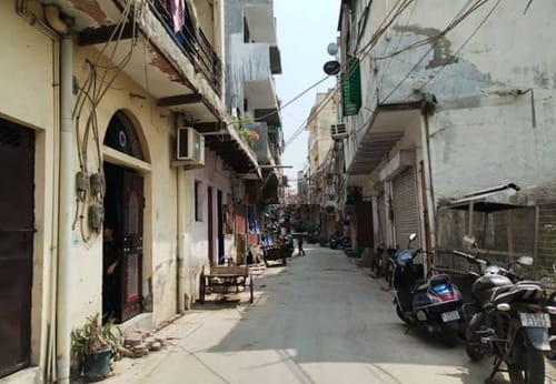
Delhi Cantonment is one of the few parts of Delhi that doesn’t quite belong to Delhi’s administrative mainstream. Governed by the Cantonment Board rather than the MCD, bordered by the Indian Air Force and Army installations that define southwestern Delhi’s institutional geography, the Cantonment area carries a different character from the civilian city around it. Jharera village sits within this territory — a small Cantonment area village in the Sector 25-adjacent belt between IGI Airport Road and the NH-48 (Delhi-Gurugram Expressway) corridor, bounded by the Subroto Park Air Force complex and the Cantonment’s residential and service infrastructure.
| Detail | Information |
| Location | Delhi Cantonment, South West Delhi / Central Delhi (Cantonment Board jurisdiction) |
| Pin Code | 110010 |
| Ward | Delhi Cantt Charge 3 / Delhi Cantt Charge 5 (different sub-localities) |
| Assembly Constituency | Rajinder Nagar (Jharera locality proper) |
| Lok Sabha Constituency | New Delhi |
| Post Office | R R Hospital (Cantonment area) |
| Nearest Metro Station | Delhi Cantonment Metro Station – Blue Line (Delhi Metro); approx. 1–2 km |
| Alternative Metro | Palam Metro Station – Magenta Line; Shankar Vihar – Magenta Line |
| Primary Road Access | Gurgaon Road (NH-48); Airport Road; Sardar Patel Marg |
| Nearest Railway Station | Delhi Cantonment Railway Station (suburban + intercity); approx. 1.5–2 km |
| IGI Airport Distance | Approx. 5–8 km |
| Key Nearby Institutions | Subroto Park Air Force Command, IARI (Indian Agricultural Research Institute), Delhi Cantt Military Hospital (R.R. Hospital) |
| Neighbouring Areas | Subroto Park; Shankar Vihar; Defence Enclave; Sanjay Vihar; Diplomatic Enclave belt |
History and Character of Jharera Village
Jharera village predates the Delhi Cantonment’s establishment as a military administrative zone. Its name has no clear documented etymology beyond being a pre-British settlement in the Delhi plateau’s southwestern agricultural belt. The Cantonment boundaries, drawn and redrawn across two centuries of British and post-Independence military administration, enclosed Jharera within the Cantonment Board’s jurisdiction rather than the civilian MCD, giving the village its specific administrative character.
The Cantonment’s governance model — services, land management, and civic infrastructure administered by the Cantonment Board with military input rather than by Delhi’s civilian municipal bodies — has both protected the area from some of the commercial development pressure seen in adjacent civilian zones and created a different kind of institutional density: military hospitals, residential quarters, sports facilities, and service infrastructure rather than commercial malls and IT offices.
The RR (Research and Referral) Military Hospital, whose post office serves as Jharera’s postal reference point, is one of India’s premier military hospitals — a 1,500-bed facility serving defence personnel and their families. Its proximity gives the village a healthcare access benefit that most Delhi urban villages don’t have nearby.
How to Reach Jharera Village Delhi
By Metro: Delhi Cantonment Metro Station on the Blue Line (Delhi Metro Line 3) is the nearest metro station, approximately 1–2 km from Jharera depending on the sub-locality. The Blue Line runs from Dwarka Sector 21 westward and then eastward through central Delhi toward Noida and Vaishali. Delhi Cantonment station connects the Cantonment area to Connaught Place (approximately 15 minutes), Rajiv Chowk (interchange with Yellow Line), and further east.
Palam Metro Station and Shankar Vihar Station on the Magenta Line provide additional metro options for the broader Jharera belt.
By Rail: Delhi Cantonment Railway Station is approximately 1.5–2 km from Jharera — a significant intercity and suburban rail connection on the Delhi-Jaipur/Ahmedabad main line, as well as the Delhi Cantonment-Hazrat Nizamuddin suburban corridor.
By Road: Gurgaon Road (NH-48) is the primary arterial — accessible from Jharera via the Cantonment road network. Airport Road and Sardar Patel Marg (which runs through the Diplomatic Enclave belt toward South Delhi) are the other key connections. IGI Airport is approximately 5–8 km.
Key Landmarks and Nearby Places
Subroto Park Air Force Command Complex
The Indian Air Force’s Subroto Park complex — named after Air Marshal Subroto Mukerjee, the first Indian Chief of Air Staff — is immediately adjacent to the Jharera belt. The complex includes the Air Force headquarters, sports facilities, and the Subroto Cup international football tournament venue.
R R Hospital (Research and Referral Military Hospital)
One of India’s premier military hospitals, R R Hospital’s presence in the Cantonment gives Jharera residents immediate access to a tertiary care facility. It is also the postal reference for the village’s sub-localities.
IARI (Indian Agricultural Research Institute) Pusa Campus
Approximately 3–5 km via Pusa Road, IARI’s sprawling Pusa campus is the country’s premier agricultural research institution. Its green belt and the broader Pusa Road corridor provide the area’s connection toward central Delhi.
Diplomatic Enclave, Malcha
The Diplomatic Enclave — with its embassies and diplomatic missions — is accessible from Jharera via Sardar Patel Marg, approximately 2–3 km. Its proximity makes Jharera part of Delhi’s diplomatic-residential geography.
Real Estate and Living
Jharera village is thinly traded on public real estate platforms due to the Cantonment Board’s restrictions on civilian property transactions within the Cantonment zone. Most housing in the area is Cantonment Board tenancy (for defence personnel and their families) rather than open market, and civilian residential plots and houses in the village’s Lal Dora area are the primary market segment for general buyers. Property data is sparse and should be verified with local brokers familiar with Cantonment area transaction rules.
The village has spacious plots and relatively low density compared to civilian Delhi urban villages of equivalent proximity to the metro. The peaceful, green character noted by residents — a product of the Cantonment’s institutional mandate against uncontrolled commercial development — is Jharera’s most consistently cited residential quality.
FAQs About Jharera Village Delhi
Q1. What is Jharera village Delhi known for?
Jharera is a village within the Delhi Cantonment area in South West Delhi, governed by the Cantonment Board rather than the MCD. It is known for its peaceful, green residential character, proximity to Subroto Park Air Force complex, the R R Military Hospital, and the Delhi Cantonment Railway and Metro stations.
Q2. Which is the nearest metro station to Jharera village Delhi?
Delhi Cantonment Metro Station on the Blue Line (Delhi Metro Line 3), approximately 1–2 km from the village. Palam Metro Station and Shankar Vihar Station on the Magenta Line are additional options.
Q3. What is the pin code of Jharera village Delhi?
110010. The area falls under Delhi Cantonment Board jurisdiction, with the assembly constituency being Rajinder Nagar and the Lok Sabha constituency being New Delhi.
Q4. Is buying property in Jharera village easy?
The Delhi Cantonment’s administrative jurisdiction imposes specific restrictions on civilian property transactions within the Cantonment zone. Property purchases need to be verified carefully for Cantonment Board tenure vs. freehold status. Village Lal Dora land is available for general buyers, but Cantonment Board tenancy properties are restricted to defence personnel. Engaging a local broker familiar with Cantonment regulations is essential.
Q5. How far is IGI Airport from Jharera village Delhi?
Approximately 5–8 km via Gurgaon Road (NH-48) and Airport Road. The village’s proximity to IGI Airport is one of its genuine advantages for frequent travellers.